Hoan Bridge (I-794 Lake Freeway)
Construction Management, LiDAR, Survey | Wisconsin | Back

Challenge
Kapur’s survey began working on the Hoan Bridge in December of 2000 when a section of it partially collapsed. The survey team set control and monitored the bridge for movement while the compromised span was prepared for demolition and repair.
Solution
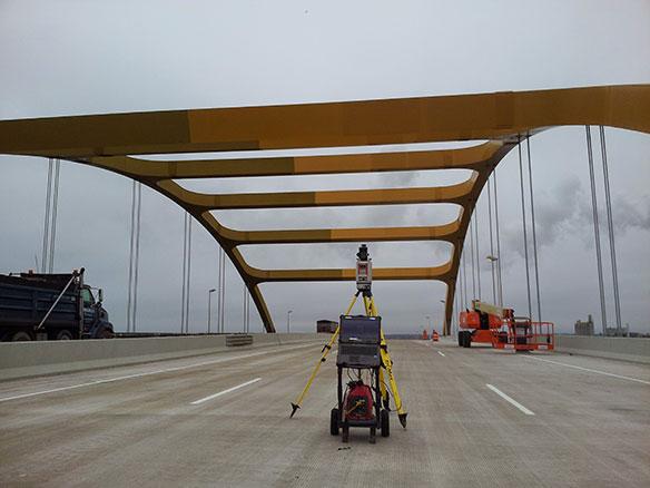
In 2013, a larger control survey was completed, which paved the way for more detailed data. The end result was required to be construction-ready data and required a very accurate and precise tolerance. Based on this highly accurate control, we developed a fused 3D surface of data by combining stationary scanning, mobile LiDAR, existing as-built data of the bridge, and data from the bridge monitoring performed in 2010.
The stationary LiDAR eloquently and efficiently recorded the existing structural features of the bridge for design analysis including complex steel girder placement as well as the piers under the bridge. Whereas the mobile LiDAR, which was used along the driveable topside, built surfaces, and steelwork from the deck up.
All collected data were utilized for topographic mapping of the area.
Services Provided
- Survey
- Mapping
- LiDAR
- Modeling
- Platting
- Construction
Industries Covered
- Survey
- Construction Management
Results
From data collection through construction, Kapur staff assisted in rehabilitation of the bridge, which now has a 40-year extension on its lifespan.