Downtown Wayfinding
Municipal | Wisconsin | Back

Challenge
When Kapur was selected as the Engineer of Record for the City of Lake Geneva, one of the first projects we delivered was an updated wayfinding inventory. The goals of this effort were to analyze the data when planning improvements within and to increase awareness of amenities within the downtown area.
Solution
Our staff gathered data regarding sign inventory and the accuracy of the information, which included performing a complete field review to locate and map all city-owned signs and creating a digital library of reference images. In addition, they also inventoried all public and private parking lots.
This information was analyzed to determine the efficacy of existing wayfinding and to develop improvements that enable visitors to find their way from parking lots to commercial areas and learn about amenities in the area.
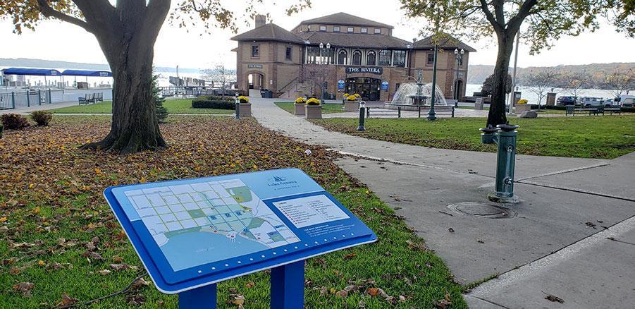
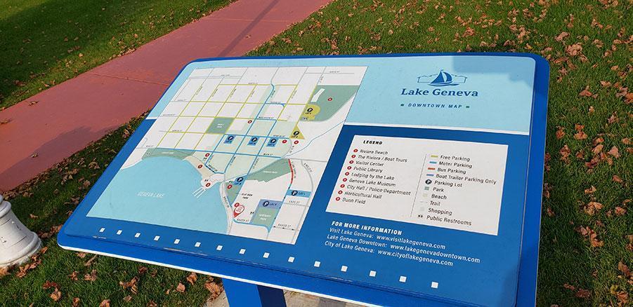
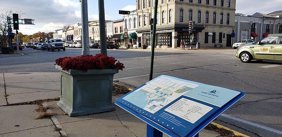
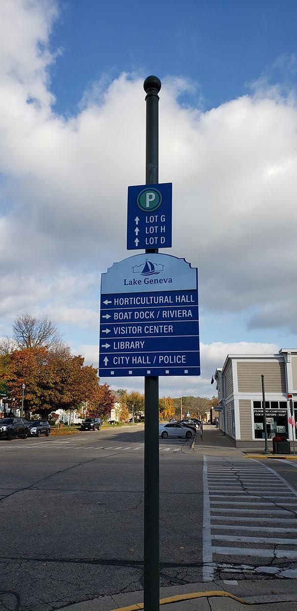
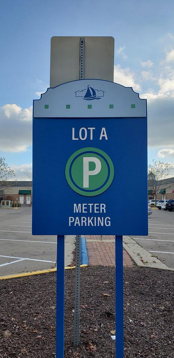
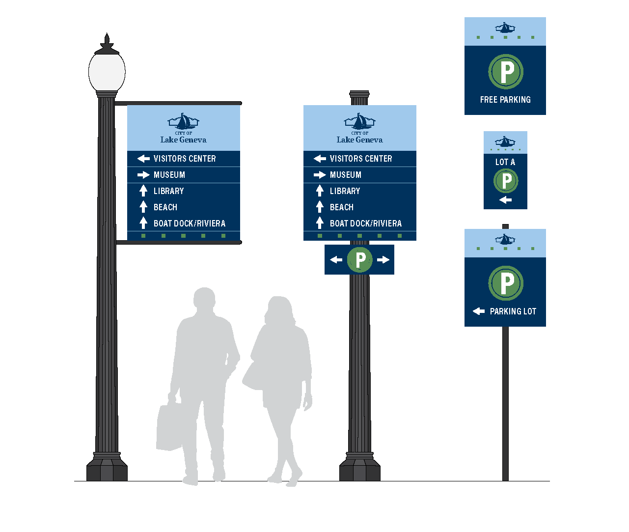
To further aid in this effort, all parking lots were named (Lot A through Lot I) and a dozen informational kiosks with mapping and signage were added throughout downtown and along the lakefront.
Services Provided
- Planning
- Municipal
Industries Covered
- Municipal
Results
The results were an easier to understand downtown and lakefront for visitors. Connecting the string of parking lots to the wayfinding system has relieved congested parking conditions within the commerce area. Directions to the parks, museum, and specialty interests such as Horticultural Hall and the Beachfront Boat Tours were clearly marked for visitors.